Survey Mapping for Existing Utilities Before a Retail Site Adds Another Pad
Adding a pad to an existing retail center sounds simple. The pavement is there, the traffic is there, and a tenant is ready to sign. Then a crew hits a water line nobody knew about.
Survey mapping for existing utilities shows what sits under and around your site before design begins. It gives your engineer real locations, elevations and easement limits to work from. Where older lines, oilfield pipelines and fast growth often overlap, a short survey now can prevent weeks of redesign later.
Locating Existing Utilities Before the New Pad Is Designed
Utility location means finding and recording where water, sewer, gas, electric, telecom and storm lines run. Do it before design starts, not after the pad is drawn.
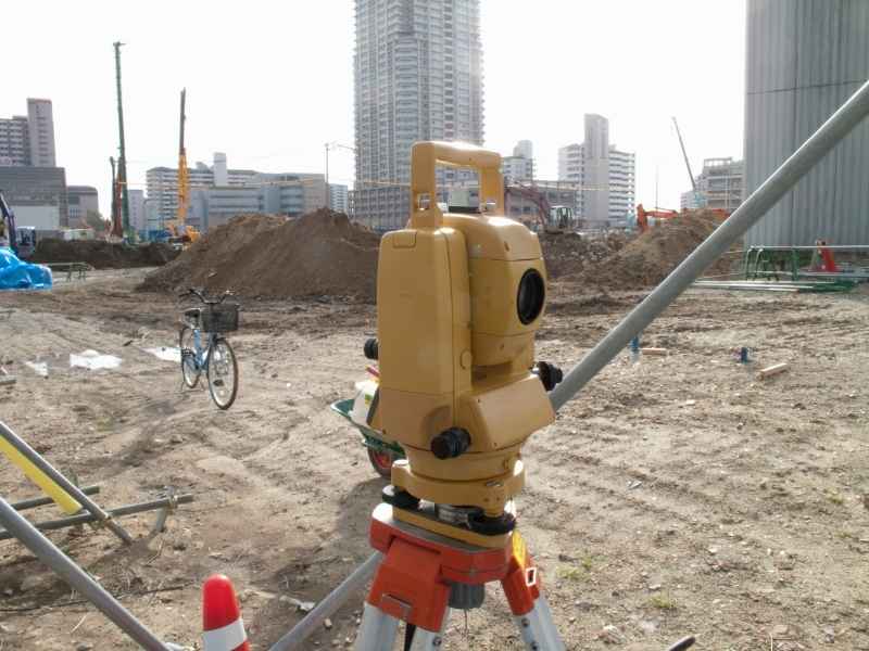
A land surveyor starts with what can be seen. That includes manholes, valves, meters, cleanouts, light poles and utility boxes. The surveyor then adds painted locate marks and any records the utility owners provide.
Locate marks from a Texas811 request are meant to help crews dig safely. They fade, get scraped off and are not built for design. A survey turns those marks into a drawing your team can use.
A good utility survey usually records:
- Visible structures and their exact positions
- Manhole and cleanout elevations
- Pipe size and material where it can be seen
- Painted locate marks from the locating crew
Older retail centers deserve extra care. Lines get moved, capped or added over the years, and the plans do not always keep up.
Mapping Utility Routes Across the Retail Development Site
Survey mapping connects the individual points into routes. The surveyor draws where each line runs across the site so the team can see what it serves and where it may conflict with a new building.
Some parts of a route are known and some are guesses. A good map shows the difference. Ask what level of detail you are getting. The ASCE 38 standard describes quality levels for utility data, from records only to lines that have been exposed and measured.
If a line runs near the planned pad or its footings, consider potholing. That means digging a small test hole to see the line’s depth and location. It costs little compared to moving a line after construction starts.
Don’t forget private lines. Fire lines, irrigation, site lighting conduit and tenant service lines often are not on public records. Sites can also have pipelines or flowlines crossing the property, so ask about those early.
Checking Easements That May Limit Pad Placement
An easement is a legal right for someone else to use part of your property. Utilities often hold them. In most cases, you cannot place a building on top of one, but the exact rules depend on the easement terms and the utility owner.
Your surveyor reads the title commitment and the recorded documents, then plots each easement on the map. A boundary survey or an ALTA/NSPS survey can show these limits clearly. Requirements vary by lender, title company and project scope.
Look for these on your map:
- Utility easements along property lines or through the lot
- Access and cross-access easements shared with neighbors
- Fire lane and drive aisle rights
- Pipeline easements, which can carry strict limits
Ask your attorney and what can be built in or over an easement. Some owners will allow limited uses with written consent. Get that in writing before design moves forward.
Coordinating Utility Survey Data With Site and Grading Plans
Utility survey data should sit in the same base file as the boundary and topography. That way the engineer designs from one set of facts instead of three.
Grade matters here. Midland is flat, so drainage often depends on small elevation changes. A new pad changes where water flows. If grading raises or lowers the ground over a line, that line may lose its cover or need a new manhole rim height.
Ask your surveyor to tie everything to the same elevation datum. Ask for a CAD file with clear layers so the design team can turn utilities on and off. A combined topographic survey and utility map keeps the work in one place.
Soil can add cost too. Hard caliche layers can make trenching slow, so moving a line is rarely cheap. Knowing the route early gives you time to design around it.
Reducing Utility Conflicts Before Retail Construction Begins
The best time to fix a conflict is while it is still a line on paper. Compare the proposed pad, footings and new service lines against the survey before plans go to permitting.
Here is a simple checklist:
- Confirm the survey scope early, before design contracts are set
- Overlay the proposed pad and utilities on one drawing
- Pothole any line close to footings or new trenches
- Talk to utility owners early if a relocation looks likely
- Order construction staking after the plans are final
Relocations can take longer than the design itself. If your closing, permit or tenant opening depends on the schedule, check with the utility owners and the city right away. Timelines and rules can vary by utility and project.