Large Acreage Planning Supported by Drone LiDAR Site Mapping
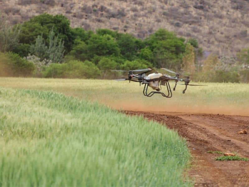
Drone LiDAR maps large tracts of land quickly by scanning the ground with lasers from the air. On big acreage, that speed is exactly what a project needs. Walking thousands of feet of open range to gather elevations by hand is slow and often impractical. A drone covers the whole property in one flight and returns a detailed picture of terrain that would take a ground crew far longer to collect.
Measuring Wide-Open Acres From Above
Large parcels are hard to survey on foot, and the bigger they get the harder it becomes. A ground crew can only cover so much ground in a day, and vast open tracts stretch well beyond that. Drone LiDAR flies over the whole property and collects elevation data across every acre in a single mission.
The payoff is a complete terrain picture instead of scattered samples. On acreage measured in the hundreds, that full coverage reveals patterns a spot survey would miss entirely. Planners get to see the land as a whole, which is where good decisions about large properties begin.
Reading Rises and Lows Across Open Land
Open land can look flat and featureless from ground level, yet it rarely is. LiDAR data reveals the gentle rises, shallow draws and low areas spread across a big tract. Those subtle features shape where things can be built and how water moves.
Reading them matters for planning. A broad low area might collect runoff during storms, or a long rise could complicate an access road. Seeing the elevation patterns across the whole property lets a team account for the terrain before committing to any design on such a large scale.
Planning Roads Across a Big Tract
Access is one of the first challenges on large acreage. Getting equipment and vehicles to the useful parts of a property often means building internal roads, and those roads have to work with the terrain. LiDAR data supports that route planning.
Terrain information helps a team evaluate:
- Where internal and service roads can run efficiently
- How gates and entrances connect to usable areas
- Which routes avoid steep grades or wet ground
- How access ties the far corners of a tract together
Planning routes against accurate terrain data, rather than a flat map, keeps roads practical and avoids expensive rework on ground that turns out steeper or wetter than it looked.
Early Calls on Energy and Development Sites
Large tracts often head toward big projects, whether energy sites, developments or industrial uses. Those projects involve heavy investment, so early information carries real weight. LiDAR data lets landowners, engineers and developers study a property honestly before design begins.
That early study shapes major decisions. The terrain data helps a team judge how much a site will cost to prepare, where the buildable areas sit and how access will work. Understanding all of that before committing keeps a large project from running into terrain surprises after the money is spent.
From Point Cloud to Something You Can Plan With
A LiDAR scan produces a point cloud, a dense mass of measured points that maps the land in three dimensions. That raw data is powerful but not directly usable, so surveyors process it into practical products. Contours, surface models and terrain maps all come from the same scan.
Those finished products feed planning across a large project. Engineers design against accurate surfaces, planners study contours and everyone works from the same reliable base. The scan is only the raw material, and the processed data is what actually drives decisions on the tract.
Frequently Asked Questions
Why choose Drone LiDAR for large acreage?
It collects detailed elevation data across huge areas far faster than a ground crew can. On tracts measured in hundreds of acres, that efficiency makes a full terrain picture practical.
What can the data show across open land?
It reveals rises, low areas, drainage patterns and subtle terrain changes that are hard to notice from ground level. Those features shape where building and access make sense.
Can LiDAR help plan access roads on a big property?
Yes. Terrain data lets a team route internal and service roads around steep or wet ground and connect the usable parts of a tract efficiently.
Is this useful before committing to a large project?
For energy, development and industrial sites, it usually is. Understanding the terrain before design helps a team judge site costs and avoid surprises after investment.
What kind of products does the survey deliver?
Point clouds, surface models, contour maps and terrain data. These processed outputs feed engineering, road planning and site design.